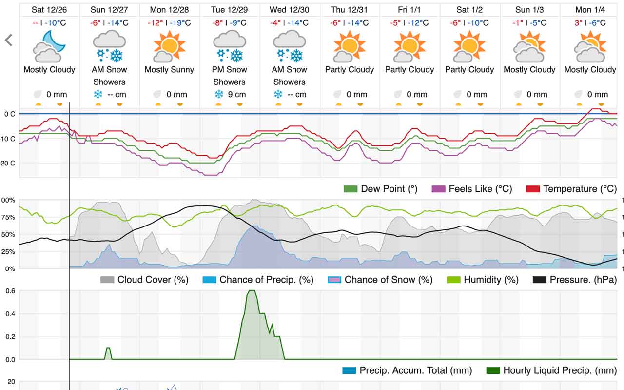
DULUTH – WEATHER – The United States National Oceanic and Atmospheric Administration (NOAA) is tracking a potential winter storm tracking into the Lake Superior region Tuesday through Wednesday night.
NOAA says, “We continue to track the potential for a winter storm to affect the region Tuesday morning through Wednesday night. As with last week’s system, the location of the heaviest snow and amounts remain uncertain. Why? Unlike last week’s blizzard, the biggest causes of uncertainty with the upcoming storm include the potential for widespread thunderstorms from the Plains into the central and lower Mississippi River Valley diverting moisture which could be used for snow”.
“The upper atmosphere jet streak which will produce this storm is still over the northern Pacific Ocean, which increases the variability in the forecast models.”
Weather Underground Weather Insight