
Thunder Bay – WEATHER – There are weather alerts and advisories out across Northern Ontario. Environment Canada is forecasting snow squalls and winter weather for the region.
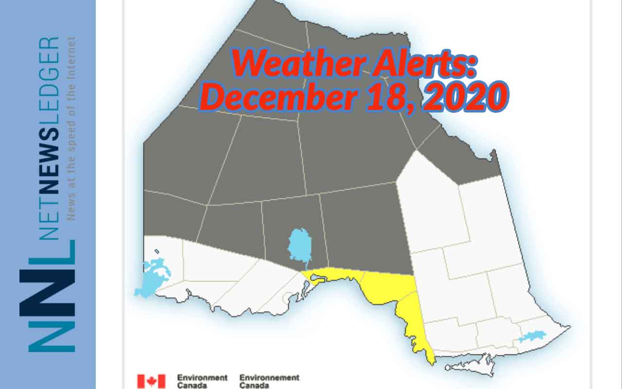
Click the link above for the full details on alerts and warnings.
Thunder Bay Outlook
It is currently -11 in Thunder Bay. We can expect increasing cloudiness through the day. Snow flurries are expected to begin later this afternoon. There is a risk of snow squalls late this afternoon as well. Total snowfall amounts locally should be between 2 to 4 cm. Winds becoming south 20 km/h gusting to 40 later this morning. Today’s high _1. Wind chill -11 this morning.
Tonight the weather service says that snow flurries will be ending this evening followed by clearing skies. There does remain a risk of snow squalls early this evening. Local amount 2 cm. Wind becoming northwest 20 km/h after midnight. Low overnight will be -11.
Sachigo Lake
It is currently -5 in Sachigo Lake. The forecast is calling for snow flurries ending late this afternoon then cloudy skies with a 40 percent chance of flurries.
There is a risk of snow squalls late this morning and this afternoon. The forecast is also for local blowing snow late this morning and this afternoon.
Environment Canada says as much as five centimetres of snow is possible. For Friday, winds will be south 20 km/h gusting to 40 increasing to 40 gusting to 60 early this morning then becoming west 40 gusting to 60 this afternoon. Showing the speed of the winter storm the temperature will be -3 as a morning high, then the temperature will fall to -17 this afternoon. The wind chill will be -11 this morning and -31 this afternoon. That means there is a risk of frostbite for exposed skin.
Tonight in Sachigo Lake, expect partly cloudy skies. There is a 40 percent chance of flurries this evening and with winds from the west at 40 km/h gusting to 60 km/h early in the afternoon to the evening hours the snow will be blowing around making visibility a challenge. Overnight the low -23, but with the wind chill -35 this evening and -30 overnight.
Kenora and Lake of the Woods
It is currently at 5:45 am CST -4 in Kenora under cloudy skies. The forecast is for snow flurries to start this morning and end this afternoon with local amounts of 2 to 4 cm. Wind will be south 20 km/h gusting to 40 becoming northwest 30 gusting to 50 early this afternoon. Friday’s high -2. Wind chill -9 this morning and -14 this afternoon.
Tonight expect clearing skies this evening. Wind northwest 20 km/h gusting to 40 becoming light this evening. Low -19. Wind chill -14 this evening and -26 overnight.


