
THUNDER BAY – Weather advisories continue across Northern Ontario. At 5:39AM EDT Environment Canada has updated the weather advisories across Northwestern and Northeastern Ontario. A flood advisory is in effect for Dryden.
Updates to follow…
Special weather statement in effect for:
- City of Thunder Bay
- Atikokan – Shebandowan – Quetico Park
- Upsala – Raith
- Sioux Narrows – Nestor Falls – Morson
- Dryden – Vermilion Bay
- Ignace – English River
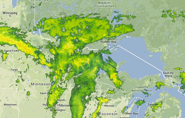
Significant rain continues.
Rain will continue across Northern Ontario today in association with a frontal system that extends from Northern Minnesota to Western Quebec. Total rainfall amounts of 20 to 40 mm are expected by Tuesday morning, although higher amounts of 50 mm or more may be possible locally due to thunderstorms. Rain will taper off Tuesday morning over Northwestern Ontario and late Tuesday over Northeastern Ontario.


